FL to CT Day 23
Atlantic City, NJ to Manasquan, NJ

We spent a layover day in Atlantic City after our trip up from Cape May to allow the Atlantic to settle down a it. Forecast was not great but better than it had been. We departed from Atlantic City at 0625 and headed back out to the Atlantic with finger crossed it was better. We underway for about 45 minutes and basically on our heading we would have for the next several hours. It sucked! The forecast was off and we still had some big seas and just at the wrong attitude to our path that was causing the boat to roll in an uncomfortable manner. We had 12 hours plus to New York and we were not going to travel that long in these seas. We turned around and headed back to Atlantic City.
On the trip back we decided we did not want to sit and wait for seas to calm down in Atlantic City… we were on a rising tide… let’s give the inside route a try. We had done it before in 2010... there were reports of shoaling form hurricane Sandy but what the heck an least we were not sitting.
The flood current was really pushing us and we were seeing speeds over 8 knots for a long time. Most of the day we had a positive boost in speed… EXCEPT for those areas where the depth sounder stopped working because it was so shallow and there were a lot of them. We never touched the bottom but we were within inches quite often. It was actually a nice trip if you take the skinny water out of the picture. Our 2010 trip had only taken us to Barnegat Light so once we past it we were seeing areas we had never been in before. This part past Barnegat was where most of the skinny water was but there were some neat areas.
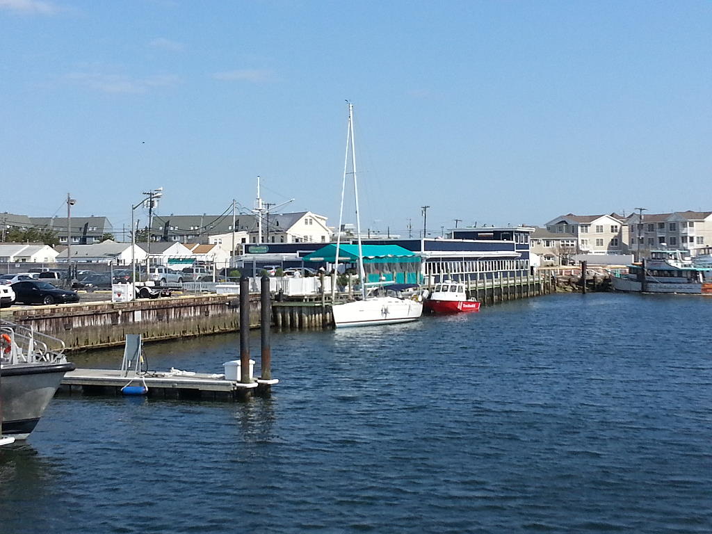
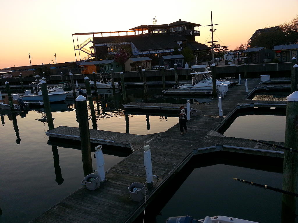
We arrived and docked at the Shrimp Box Restaurant in Manasquan at approximately 1600. No power or water but typically a FREE dock for the night. Our position at the marina
N40°06.098’, W074°02.246’. We traveled today for 9 hours and 35 minutes covering 65.8 nautical miles averaging 6.9 knots.
Posted at 5:54 PM
FL to CT Day 22
Chesapeake City, MD to Atlantic City, NJ
We departed from Chesapeake City this morning at 0630 with an ebb tide that pushed us to over 10 knots within minutes. We maintained this boost of speed until we exited the east end of the C&D Canal where the brakes came on with a flood tide starting… between 5 and 6 knots out the Delaware River and Delaware Bay. Just before Cape May we started picking up boost again as the tide switched again to ebb.
We crossed through the Cape May Canal and out the Cape May Inlet into the Atlantic at approximately 1430. We were concerned about how the seas would be. We had seen conflicting reports so best way to be sure was to actually go out and see for ourselves. Initially it was not bad with a 3-4 swell out of the NNE…. 8-9 second period so it was like a roller coaster. There was a fairly good 10-15 knot wind also out of the NE producing a chop on top of the swells.
After about 15 minutes of running north I checked with Susan is she was comfortable with the waves and the ride. She was not happy but said she wanted to get the Jersey Shore done as fast as we could. She hate this part of the trip because of the seas. They can be really bad at times and to rock and roll for hours on end is just not emjoyable.
Well… the seas changed about 2 hours our and for the last 4 hours from Cape May to Atlantic City we had 8-10 foot swells and the chop had increased to 2-3 waves on top of it. The ride became a little rough and Susan was not a happy camper…. I did not enjoy it either…. We may be sitting in Atlantic City till it settles down a little more.
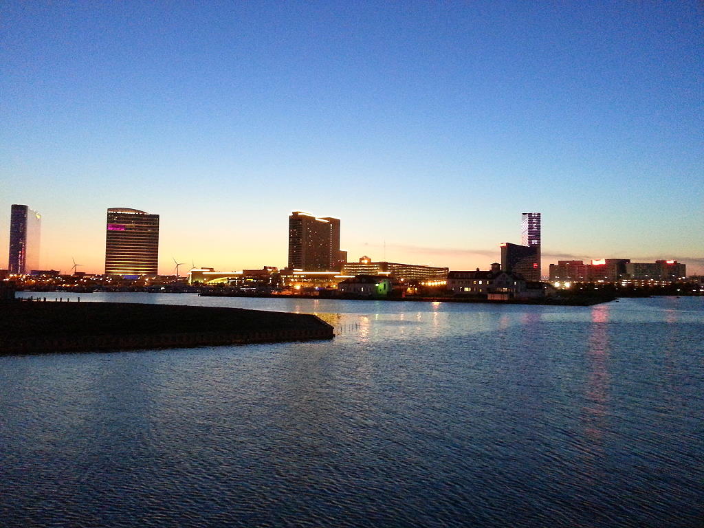
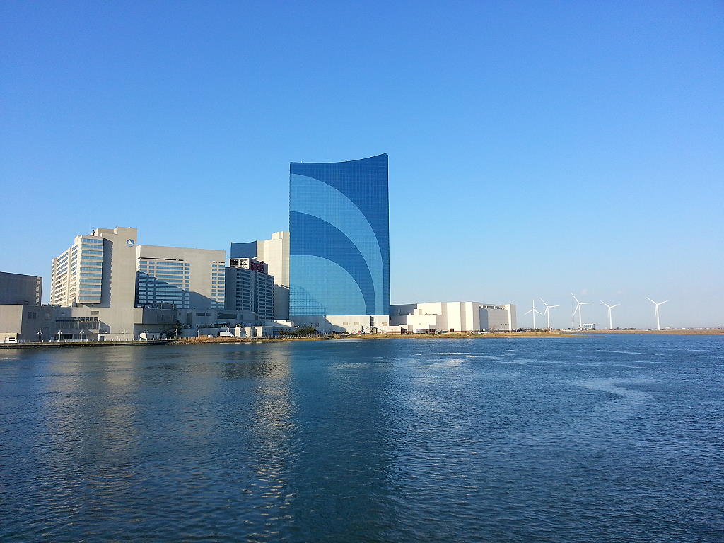
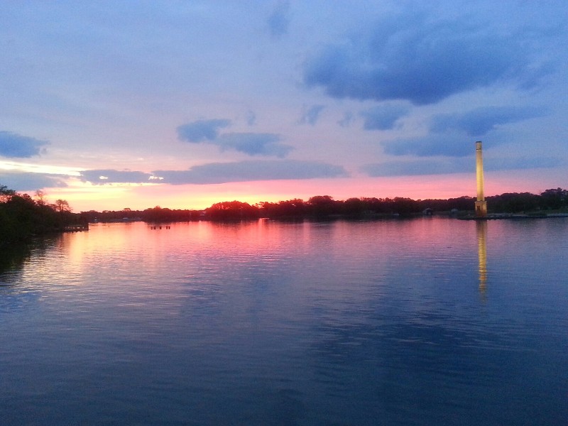
We arrived to Atlantic City at 2000 and were securely docked at Gardener’s Basin at 2015. Our position tonight is
N39°22.597', W074°25.264'. We traveled today for 13 hours and 45 minutes covering 99.4 nautical miles averaging 7.2 knots.
Posted at 7:55 PM
FL to CT Day 21
Reedville, VA to Chesapeake City, MD
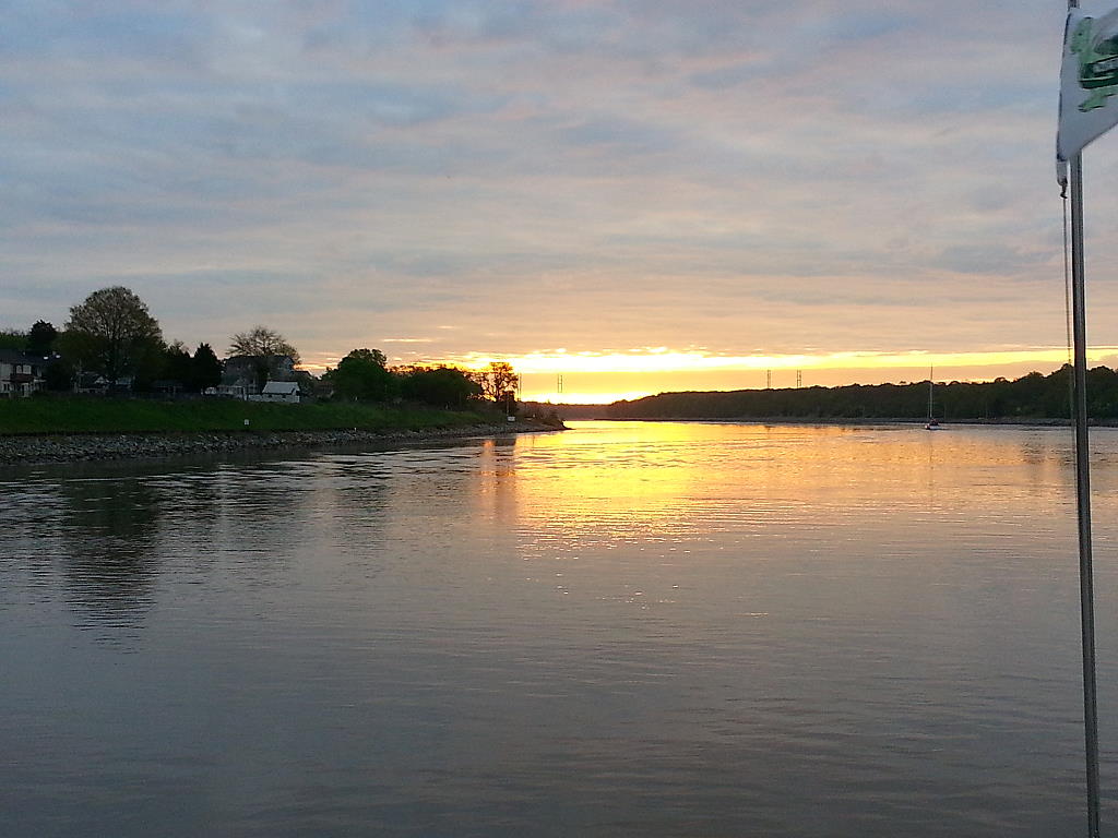
We departed from Reedville this morning at 0610 with a beautiful sunrise before us as we exited Cockrell Creek and the Great Wicomico River toward the Chesapeake Bay. The forecast was for some nasty weather coming in late tonight and a bad forecast for all day Friday. We wanted to get as far up the bay as we could today and be in a protected area tonight for the approaching weather.
Normally on this day we would travel to Galesville, MD off the West River on the western shore of the bay. They have a small town dock that is just big enough for us to dock. There is no power or water and it’s a little chilly outside at night now dropping into the 40’s so heat all night long is nice. Otherwise we run the generator for the evening while we still up… but once we go to bed the generator is shut down and no heat for the rest of the night. Exploring the options to us for overnight locations we decided to continue on to what would have been our destination for Friday night… Chesapeake City, MD on the C&D Canal. There is a nice town dock there and dockage is free only charging for power or water. $15 for electric… $10 for water. It’s totally protected from any weather and compared to Galesville it’s a luxury resort. Susan loves browsing through all the little chops adjacent to the docks. So, it was a plan!
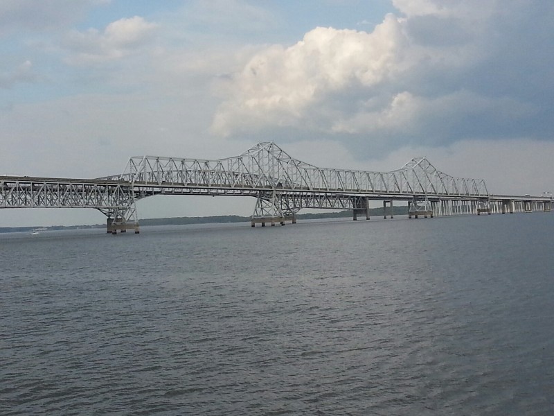
Not going to Galesville moved our course from the western shore of bay to the eastern shore so the scenery was new to us… not that you can see a lot as you are still a few miles off the shore but it made a difference at the Chesapeake Bay Bridge as we were going under it in the eastern channel and a whole different looking bridge than the suspension portion of the bridge spanning western ship channel.
It also meant a lot more fishermen out pulling their toy boats behind them. At least that is what they look like… trolling rigs of some sort that spread out each side of their boat 150 feet at least and they just do not get the idea that a large boat is heading straight at them and they should try to avoid them rather than zigzag across in front of them. They sure get mad when you run right over the “toy boat” they are dragging behind them. JUST KIDDING! We did not run over any but if you even get close they get real upset and start making these strange gestures with their arms. Just hard for me to understand… we are on a straight course down a marked channel and they are crossing my bow and get upset at me…. Hmmmm.
Just after the bay bridge the weather started to deteriorate. Winds picked up to a steady 20 knots with gusts close to 30 knots and rain. Thunderstorms! Luckily we seemed to in between the bad bands of weather and only catching the winds with just intermittent rain, but it did kick the waves up from what had been a flat clam day. NE winds right on the bow and 2-3 choppy waves that make more noise than anything else. About 3 hours to Chesapeake City at this point with a slight boost in current pushing just over 7 knots but it changed to against us before we arrived. One hour ETA with 7 miles to go and we started losing our boost of current. The hour turned into an hour and half Before we arrived we had slowed to a snails pace at 4.4 knots with over 2 knots of current on our nose.
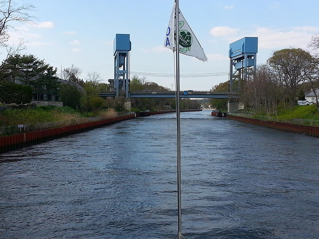
We arrived to Chesapeake City at 2345 and turned the corner into the basin where the docks are and there was not a single boat on the docks… YEAH! We had been worried that we traveled so long only to find the docks full and we did not have a backup plan. BUT, they were empty. We approached the dock and I instructed Susan that we would go to mid dock to be further in from the C&D Canal boat traffic that can cause some wake at times even though it’s a no wake zone. We got close to dock and discovered that reason no boats were on the docks. The docks were closed… under repair with no decking just the framework on top of the floats. NO! There had been no notices of this in any of the sources we use while we cruise.
Plan 2… NOPE, we had not made a backup plan. I moved to the marina adjacent to town docks at the Chesapeake Inn and the 7.5 foot depth at the town dock started dropping fast… 7, 6, 5.8, 5.6. 5.4, 5.2…. LAST LAST LAST started flashing on the screen.. meaning less than 5 feet deep… it was close to between mid and high tide so we were not docking here with a 3.5 tide rise and fall. We would sitting in the mud. OK… only other option was across the canal at Schaefer’s Canal House Marina.
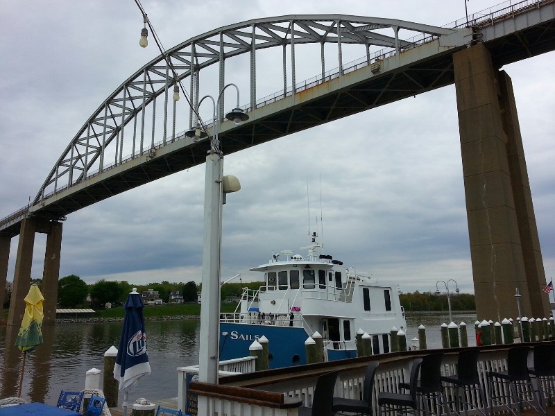
Docking there was interesting as we had the 2 knot plus current to deal with but we did well… we did not damage the dock or SAILS…
At 0010 we were securely docked with power on at Schaefer’s Canal House Marina. Our position at the marina N39°31.79', W075°48.789'. We traveled today for 18 hours covering 122.2 nautical miles averaging 6.8 knots.
The night was a little noisy with car traffic… docked right under the Chesapeake City Bridge and the $15 for dockage went to over $100 for dockage but we were safe and sound for the night and it’s a good place to be able to rendezvous with our friends Jim and Cathy Fisher who were so kind as to receive our forwarded mail for us. Beecha’s meds were coming in the mail and we are out of them as of today so the timing was perfect. Jim and Cathy are coming for lunch.Posted at 4:43 PM